
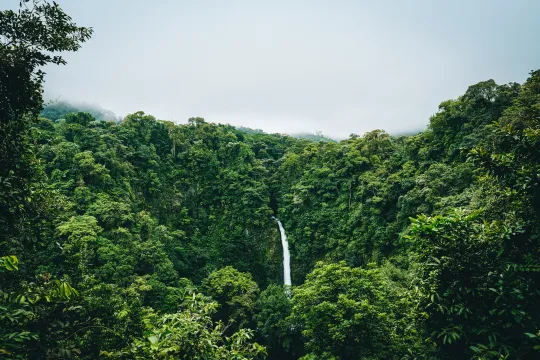
What Are Primary Forests and Why Should We Protect Them?

This resource has been reviewed by SubjectToClimate's climate scientists and verified for scientific accuracy and up-to-date information. Learn about our review process →
Provided by: Global Forest Watch|Published on: January 17, 2023
Articles/WebsitesScientist Reviewed
6789101112
Scientist Reviewed This resource has been reviewed by SubjectToClimate's climate scientists and verified for scientific accuracy and up-to-date information. Learn about our review process →
Synopsis
- In this article, students will read about ecological succession, primary forests, and why it's important to protect them.
- The article includes a diagram of ecological succession and an interactive map that allow students to explore where the remaining tropical primary forests exist on Earth.
Subjects: Biology, Earth and Space Sciences, Geography
Authors: Global Forest Watch, Sarah Ruiz
Region: Global
Languages: English
Teaching Materials
Positives
- Terms and statistics used throughout the article are hyperlinked to scientific papers or websites to provide definitions, additional information, or context.
- The interactive map showing the locations of remaining tropical primary forests is a great visual tool.
Additional Prerequisites
- Students should be familiar with the terms ecology, ecosystem, and species.
Differentiation
- Students can further explore the map by clicking the link to "Explore on GFW" which takes you to a more detailed version with many layers, including different types of land cover, fire alerts, land use, and biodiversity options.
- The diagram and map could be used in lower grades when discussing geography and ecological succession.
- Higher grades could use the article to discuss the importance of old-growth forests for biodiversity.
- Cross-curricular connections can be made with math classes by challenging students to calculate the percentage of old growth/primary forests that have been lost.
Students will understand the concept of ecological succession to help in developing strategies for improved forest regeneration. The resource including mapped data points is accurate and recommended for teaching.
Teaching Tips
Standards
Resource Type and Format
About the Partner Provider
Global Forest Watch
Global Forest Watch (GFW) is an online platform that provides data and tools for monitoring forests. By harnessing cutting-edge technology, GFW allows anyone to access near real-time information about where and how forests are changing around the world. GFW is used every day to monitor and manage forests, stop illegal deforestation and fires, call out unsustainable activities, defend land and resources, sustainably source commodities, and conduct research at the forefront of conservation.
Scientist Reviewed
This resource has been reviewed by SubjectToClimate's climate scientists and verified for scientific accuracy and up-to-date information. Our review process ensures that every resource in our library reflects the current state of climate science.
Learn about our review process →