
River Runner

This resource has been reviewed by SubjectToClimate's climate scientists and verified for scientific accuracy and up-to-date information. Learn about our review process →
Provided by: River Runner|Published on: January 21, 2022
Data, Graphs, and MapsScientist Reviewed
6789101112
Scientist Reviewed This resource has been reviewed by SubjectToClimate's climate scientists and verified for scientific accuracy and up-to-date information. Learn about our review process →
Synopsis
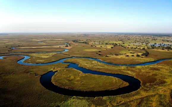
- This video game-like interactive map lets students place a "raindrop" anywhere on Earth to see where the water will end up.
- Students will enjoy taking a ride with the raindrop through the waterways of the topographical map.
Subjects: Earth and Space Sciences
Authors: River Runner
Region: North America, Global, New Jersey
Languages: English
Teaching Materials
Positives
- The total length of the raindrop's journey, the names of the waterways, and a map of the route add more information and interest to the raindrop's journey.
- The speed of the animation can be controlled.
Prerequisites
- This resource is still in beta testing, so while most of the North American waterways are labeled, quite a few of the river names in other parts of the world are still missing.
Differentiation & Implementation
- Geography classes could use this resource to study the major waterways of a region. After students are familiar with the region, the teacher could ask students to predict the path of a raindrop and use the interactive map to see if their predictions are correct.
- Elementary classes could use this tool as an introduction to the concepts of gravity and elevation.
- Advanced classes could work in groups to identify the unnamed waterways in a specific region and submit the suggestion on the website.
- Other resources on this topic include this activity from the National Environmental Education Foundation on protecting watersheds, this article about how climate change is affecting rivers in the United States, and this water cycle game.
This resource is a fascinating interactive website that allows users to pick any location in the world to place a "raindrop" and then see the path taken from that point until it reaches an ocean. After selecting a point, the tool shows the full path taken by that raindrop and then initiates an animation which follows the path from beginning to end. The speed of the animation is controllable. This resource is well-done (although currently it's in beta testing) and easily conveys the complexity of water runoff and water basins. This resource is recommended for teaching.
Teaching Tips
Standards
Resource Type and Format
Scientist Reviewed
This resource has been reviewed by SubjectToClimate's climate scientists and verified for scientific accuracy and up-to-date information. Our review process ensures that every resource in our library reflects the current state of climate science.
Learn about our review process →