
Earth: Apple of Our Eye

This resource has been reviewed by SubjectToClimate's climate scientists and verified for scientific accuracy and up-to-date information. Learn about our review process →
Provided by: Population Education|Published on: June 24, 2022
Lesson PlansScientist Reviewed
345
Scientist Reviewed This resource has been reviewed by SubjectToClimate's climate scientists and verified for scientific accuracy and up-to-date information. Learn about our review process →
Synopsis
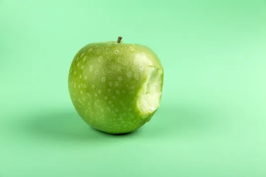
- This lesson plan on food production and agriculture centers around a demonstration that uses an apple to show students the small fraction of Earth's land that can be used for farming, followed by discussion questions and a follow-up activity.
Subjects: Science, Mathematics
Authors: Population Education
Region: Global
Languages: English
Teaching Materials
Positives
- Teachers can use the apple demonstration for students in a range of grade levels and then modify the remainder of the lesson to fit the age and ability levels of their students.
- This lesson is engaging and thought-provoking, especially for visual learners.
Additional Prerequisites
- Teachers who have not used the Population Education website before need to enter an email address to download the lesson plan.
- Students should have a basic understanding of fractions.
- Teachers will need an apple, a knife, and paper towels or a plate for the demonstration.
Differentiation
- This resource would be a great lesson for elementary math classes that are working on fractions, where students could also use modeling clay to divide up the segments.
- This could be used in a geography or social studies class for lessons about where people live and where we grow food.
- Before cutting the apple, teachers could have students predict what fraction of the Earth is used for farming and then compare the students' predictions to the actual fraction.
- After going through the discussion questions, students could discuss with a partner or write down what was surprising and interesting about the lesson.
- Other related resources include this video about creating a perfect farm, this article on food waste, and this activity about the space needed to grow food.
The resource models land availability and explains the impact it has on the agricultural system. This is recommended for the classroom.
Teaching Tips
Standards
Resource Type and Format
About the Partner Provider

Population Education
Population Education provides K-12 teachers with innovative, hands-on lesson plans and professional development to teach about human population growth and its effects on the environment and human well-being. Human population has grown from 1 billion to 8 billion in just over 200 years, so it is critical to examine human impacts on wildlife, climate, and natural resources while working toward equality and justice for the world’s people. Through memorable, standards-aligned classroom activities like simulations, cooperative challenges, and debate, Population Education inspires students to tackle a variety of real-world problems and to become positively engaged in their communities as the next generation of leaders and policy makers.
Scientist Reviewed
This resource has been reviewed by SubjectToClimate's climate scientists and verified for scientific accuracy and up-to-date information. Our review process ensures that every resource in our library reflects the current state of climate science.
Learn about our review process →